Dealer in Rare and First-Edition Books: Western Americana; Mystery, Detective, and Espionage Fiction
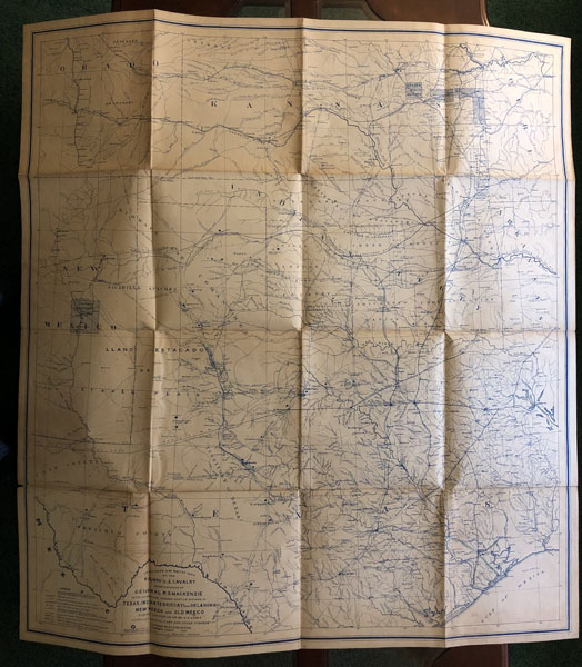
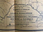
Trails Made And Routes Used By The Fourth United States Cavalry Under Command Of General R. S. Mackenzie In Its Operations Against Hostile Indians In Texas, Indian Territory, New Mexico And Old Mexico During The Period Of 1871-2-3-4 And 5.
E. D.--PREPARER DORCHESTER
Other works by E. D.--PREPARER DORCHESTERPublication: 1927, Freeport, Texas
Large Folding Map. 38.5" x 35.5". Scale: 1 Inch=23.76 Miles. "Compiled from military and other surveys; prepared by E. D. Dorchester, Freeport, Texas, 1927. The map shows counties; territories; towns; roads; forts; rivers; camps; water holes; mountains; Indian reservations; location of Indian tribes; depot in Indian Territory; railroads; Indian villages; California Mail Route; routes of the ride from Galveston, Texas, by boat, rail, "hack," and ambulance in 1870, 1871, 1872, 1873; old roads and trails; trail of MacKenzie's column 1871, 1872, 1873, 1874, 1875; trail of MacKenzie's column into New Mexico 1872; raid into Mexico May 17-19, 1873; the Jesse Chisholm trail from San Antonio, Texas, to Dodge City and Abilene, Kansas; camps of General MacKenzie's command 1871-1876; old forts, posts, and camps; actions with Indians by Fourth Cavalry in 1871-1875; Fourth Cavalry detachments 1871-1876. All trails of military parties have dates and leaders listed. Battle sites include dates."--Maps of Texas 1527-1900 p.86,#1539. Produced from the manuscript original map located at Texas Tech University. "Supervised by Captain. R. G. Carter, Retired U.S. Army, last surviving officer under Gen'l Mackenzie". The map is produced on heavy paper, is folded, with no tears or losses. Near fine copy of this rare and important map. Our research identifies no auction records and only 2 copies held in institutional libraries. Protected in custom cloth portfolio.
Inventory Number: 52919


