Dealer in Rare and First-Edition Books: Western Americana; Mystery, Detective, and Espionage Fiction
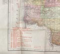
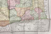
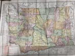
The Rand-Mcnally Vest Pocket Map Of Washington. Railroads And Electric Lines, Counties, Congressional Townships, Cities, Towns, Villages, Post Offices, Lakes, Rivers, Etc
RAND MCNALLY AND COMPANY
Other works by RAND MCNALLY AND COMPANYPublication: Rand McNally & Company, 1910, Chicago
First edition. 6 1/2" x 4" printed gray folder, n. p. [4 pp.], advertisements, 20" x 27" color folded map of the state of Washington. that covers all pertinent information of the day regarding the state. The verso provides information regarding counties, creeks, Indian Reservations, islands, mountains, river and towns, etc. Map and folder in near fine condition.
Inventory Number: 49364$575.00


