Dealer in Rare and First-Edition Books: Western Americana; Mystery, Detective, and Espionage Fiction
The Port Of Portland. Portland, Oregon. United States Of America / (Title Page) The Port Of Portland. Portland, Oregon, U.S.A. Reliable Maps And Data Of Portland And Vicinity, Also Of The Columbia And Willamette Rivers And Their Tributaries
The Port Of Portland Commission
Other works by The Port Of Portland CommissionPublication: Kennedy Co, 1912, Portland
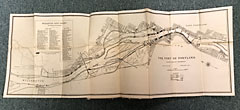
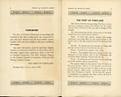
First edition thus. 8" x 5" in gray cloth with printed borders and title in black on front cover. 16 pp. An invaluable map, handbook and guide issued for the Port of Portland detailing not only the amount of timber, agriculture, and other products moving through the port, but also listing all of the wharves and warehouses available for the maritime shipper. A 23 1/2" x 24 1/2" color lithograph pictorial Map of the Columbia River Basin. The map of the Columbia River Basin tracing the river’s course from British Columbia through Washington down into Oregon to the sea, indicating all of the branch railroads off of the Columbia. One 13" x 35" map of the Wharves and Docks of the Port of Portland. One 21" x 31 1/2" map of the Mouth of Columbia River as of June, 1911 with soundings and buoy positions noted. The Mouth of Columbia River map was a vital resource at the time as Columbia carries large amounts of silt,needing constant dredging, and well known to be particularly treacherous to navigate. All three maps with minor closed tears at the creases and folds and one minor tear to the color lithograph map. Soiling to covers along with scraping and bumping to corners, edges and spine. From the library of George Harold Bowker who was a clerk with the Portland Stevedoring Co. Very good.
Inventory Number: 47227


