Dealer in Rare and First-Edition Books: Western Americana; Mystery, Detective, and Espionage Fiction
The Illinois Central Rail-Road Company Offers For Sale Over 2,000,00 Acres Selected Farming And Wood Lands In Tracts Of Forty Acres And Upwards, To Suit Purchasers, On Long Credits And At Low Rates Of Interest, Situated On Each Side Of Their Rail-Road, Extending All The Way From The Extreme North To The South Of The State Of Illinois.
Illinois Central Railroad
Other works by Illinois Central RailroadPublication: John W Amerman, Printer, 1856, New York
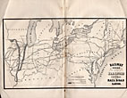
9" x 5-1/2" tan printed wrappers. 64pp. Two black and white frontispiece maps. The first map is 9" x 5-1/2" and is entitled "OUTLINE MAP OF ILLINOIS." The second map covers 2 pages, 10-1/2" x 6-3/4" and is entitled "RAILWAY GUIDE TO THE ILLINOIS CENTRAL RAIL ROAD LANDS." Everything you would want to know about settling down in Illinois is in this booklet to include railroad routes, value of land for farming, value of crops, towns and villages. The Company owns valuable tracts of iron and lead ores, also coal beds of immense richness. "Illinois Is now in the start of its great advance towards becoming the first producing State in the Union. Having Lake Michigan on one side, furnishing a constant outlet for its produce, the Mississippi to the west, with its tributaries, the Illinois and Rock Rivers, both navigable streams, running far into its interior, the Wabash on its eastern borders, and Ohio on the south, the natural facilities would seem unequaled in the world." Several letters from successful farmers telling of the advantages and prospects of Illinois. Other subjects discussed are the climate, soil, health, coal, Illinois Central Railroad Lands, the cost of opening a farm, the population, agriculture, statistics of towns et. al. Light wear to the extremities along with chipping to spine, lower fore-corner of front wrapper creased, wrappers discolored else a good+ copy.
Inventory Number: 38108


![Pacific & Idaho Northern Railway Construction Photograph Album Archive 1909-1911 HOLLAND, ROBERT T. [ENGINEER]](/media/images/thumb/44543.jpg)


