Dealer in Rare and First-Edition Books: Western Americana; Mystery, Detective, and Espionage Fiction
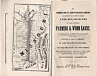
The Hannibal And St. Joseph Railroad Company Have Received By Grant From Congress Over 600,000 Acres Of The Choicest Farming & Wood Lands, The Greater Portion Of Which Is Now In The Market, And The Remainder Will Be Offered From Time To Time. Sales Will Be Made By Agreement In Lots To Suit Purchasers, On Ten Years Time And Five Per Cent. Interest. These Lands Are Situated On Each Side, And Within Fifteen Miles Of The Hannibal And St. Joseph Railroad, Extending Entirely Across The State, In Northern Missouri
HUNT, JOSIAH [LAND COMMISSIONER H. & ST. JO. R. R.]
Other works by HUNT, JOSIAHPublication: Press of Geo C Rand & Avery, 1859, Boston
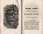
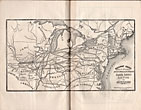
First edition. 8vo. 8 1/2" x 5 1/2" yellow printed wrappers, 60 pp., illustrated from six full-page engraved plates, two maps. One map is a double frontispiece map of the eastern U. S. into Missouri and showing the lines of the H. & St. Jo. R. R. in Missouri. The other full-page map is of Northern Missouri showing the H. & St. Jo. R. R. lands with a shaded part to show the extent of the lands between Hannibal and St. Joseph. Excellent descriptions of the advantages of the land, crops, stock raising, manufactures, education, markets, Hannibal, St. Louis, St. Joseph, letters from satisfied farmers of hemp, tobacco, and other crops. Minor foxing to the page fore-edges else a clean, fine copy.
Inventory Number: 33981
![The Hannibal And St. Joseph Railroad Company Have Received By Grant From Congress Over 600,000 Acres Of The Choicest Farming & Wood Lands, The Greater Portion Of Which Is Now In The Market, And The Remainder Will Be Offered From Time To Time. Sales Will Be Made By Agreement In Lots To Suit Purchasers, On Ten Years Time And Five Per Cent. Interest. These Lands Are Situated On Each Side, And Within Fifteen Miles Of The Hannibal And St. Joseph Railroad, Extending Entirely Across The State, In Northern Missouri HUNT, JOSIAH [LAND COMMISSIONER H. & ST. JO. R. R.]](/media/images/large/33981.jpg)


