Dealer in Rare and First-Edition Books: Western Americana; Mystery, Detective, and Espionage Fiction
S. E. L. Maduro & Sons' Coaling Station At Curacao, Dutch West Indies
S. E. L. MADURO & SONS
Other works by S. E. L. MADURO & SONSPublication: Unz & Co, Print, n d (ca 1914), New York
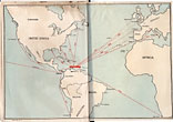
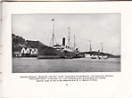
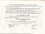
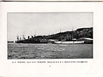
5 1/2" x 7 1/2" oblong color, pictorial wrappers, 32 pp., illustrated from photographs, maps, one folding color map. The maps are "Outline Map of St. Anna Harbor, Curacao, Dutch West Indies" and an untitled map showing shipping routes and distances from Curacao to ports in the U.S., England, France, Spain, Italy, Chile, and South Africa. The text promotes Curacao as having "the best natural harbor in the world," ideally placed for steamers en route to the Panama Canal to safely and quickly refuel with affordable coal. The illustrations show the wharves populated with ships from around the world, and testimonials are reproduced from customers who have been satisfactorily supplied with coal and fresh water by Maduro & Sons. The company was founded in 1837 and remains in business today. OCLC locates two copies, one in Curacao and one in the Netherlands. A few minor marginal annotations, and folded color map is lightly chipped on one side, else a very good copy.
Inventory Number: 46026

