Dealer in Rare and First-Edition Books: Western Americana; Mystery, Detective, and Espionage Fiction
Road Map Of Utah
State Road Commission Of Utah
Other works by State Road Commission Of UtahPublication: Smith-Brooks Press, 1939, Denver
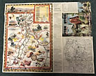
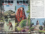
28" x 22 3/4" sheet folded to 36 panels. 18 panels offers a road map of Utah and with legend. Index to cities and towns as well as populations shown on borders. Inset at foot of sheet is a listing of historical markers. Opposite 18 panels offers 2 colorful cover panels, a 2-panel black and white map showing paved and graded roads in the western U.S., and a 22 1/2" x 14" color pictorial map of the state and with a listing of and a bit of information on "Outstanding Scenic and Recreational Attractions," each of which are highlighted on the pictorial map. Light wear to edges and folds. Very good.
Inventory Number: 46819$175.00


