Dealer in Rare and First-Edition Books: Western Americana; Mystery, Detective, and Espionage Fiction
Rand Mcnally Pocket Maps Of Colorado For Tourists, Travelers, Shippers, General Commercial And Business Reference
RAND MCNALLY & COMPANY
Other works by RAND MCNALLY & COMPANYPublication: Rand McNally & Company, 1942, Chicago
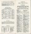
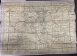
Edition 1942. 8vo. 9 1/4" x 4 1/4" color pictorial wrappers, 32 pp., large folding map. The folding map is in full color and is a complete indexed reference map showing all cities, towns, counties, railroads, waterways, and physical features. Provided in the booklet is an alphabetical list of cities and towns with complete populations for the 1940 census. Also the index locates all places on the map and indicates freight, express, telegraph, banking and postal facilities of all cities and towns. The large folding map is in fine condition and the booklet covers are lightly used, else a very good copy.
Inventory Number: 49365$525.00


