Dealer in Rare and First-Edition Books: Western Americana; Mystery, Detective, and Espionage Fiction
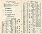
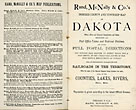
Rand, Mcnally & Co's Indexed County And Township Map Of Dakota With A New And Original Compilation And Index, Designating All Post Office Towns And Railroad Stations, And Giving Full Postal Directions For Sending Mail Matter To Every Place Not A Post Office, In The Territory, Known In The Post Office Department As "Locals," Also, Giving An Alphabetically Arranged List Of The Railroads In The Territory (With The Name Of The Express Company Doing Business Over Such), And Of All Counties, Lakes, Rivers, Etc. Etc. (Cover Title)
RAND, MCNALLY & COMPANY
Other works by RAND, MCNALLY & COMPANYPublication: Rand, McNally & Co, 1883, Chicago
Large 26 1/2" x 20 1/2 " full-color folding map of Dakota Territory that details all locations of railroads, counties, Indian Reservations, creeks, mountains, buttes and hills, rivers, towns, etc. All locations are indexed with locations for each provided. Tiny tears to a few fold creases else a fine, brightly colored, unused map of 1883 Dakota Territory.
Inventory Number: 48548$750.00


