Dealer in Rare and First-Edition Books: Western Americana; Mystery, Detective, and Espionage Fiction
Ontario. Canada's Premier Province. The Lake-Land Playground / (Title Page) Ontario. Premier Province Of Canada. The Lakeland Playground
Government Of Ontario
Other works by Government Of OntarioPublication: The United Press Limited, nd ca 1922, Toronto
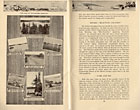
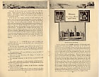
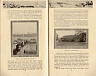
8" x 5" in pictorial wrappers printed in black, green and tan and showing a picnic scene in the background and a car traveling down a street in the foreground. 72 pp. Illustrations. Pages are cream-colored. Overview of Ontario followed by information on the southern entrance to Niagara; the southwestern gateway into Ontario; Ontario's "Blue Water" Highway, which runs very close to the eastern shoreline of Lake Huron and include cities Grand Bend, Goderich, Kincardine, Sarnia, Owen Sound, etc. Information on Toronto, the Kawartha Lakes Region, Bon Echo, Kingston, Ottawa, the Muskoka District, the Lake of Bays, the Algonquin Park, Lake Nipissing and the French river, Timagami, Saulte Ste. Marie, Port Arthur, fort William, Nipigon, Queico Provincial Park, Lake of the Woods area, Minaki, etc. 2 pages listing the locations of golf courses or clubs along with number of holes and total length of yards. 3 pages listing camping sites in Ontario along with brief description of each. Listing of game and fish laws ad fees. At the top of each page is an illustration of a vehicle driving along. Numerous black and white illustrations of scenery, important buildings, people involved in activities, street scenes, etc. Center page disbound from lower staple. Light soiling to wrappers and with light wear to the extremities. Very good.
Inventory Number: 42675


