Dealer in Rare and First-Edition Books: Western Americana; Mystery, Detective, and Espionage Fiction
Oklahoma, Frisco Line
SNYDER, BRYAN [GENERAL PASSENGER AGENT]
Other works by SNYDER, BRYANPublication: Press of Woodward & Tiernan Printing Co, 1899, St Louis
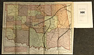
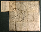
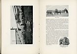
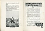
First edition. 19 x 13 cm. (7 1/2" x 5 1/8") original pictorial wrappers, n. p. [60 pp.], illustrated from photographs, folding map tipped-in at front of text : 48 x 35 cm. [19" x 13 3/4"] Correct Map of Oklahoma and Indian Territories, Showing Points Reached By The St. Louis & San Francisco Railroad. Also contains a small inset map of the Oklahoma panhandle. A 50 x 50 cm. [19 3/4" x 19 3/4"] folding map is tipped-in at the rear: Correct Map Of The Territory Reached By St. Louis & San Francisco Railroad. Illustrated with photographs of agricultural endeavors and a few town scenes. Map in the front is printed in full color and depicts each county, as well as Indian Territory and the routes of the St. Louis & San Francisco Railroad. Rear map is printed in black and shows the route of the S. L. & S. F. Railroad as it extends through portions of Missouri, Arkansas, Kansas Texas, Oklahoma, and Indian Territory. Individual counties are also noted. Text promoting Oklahoma and her agriculture, climate, industry and mineral resources. Stamp of Perry and Dowden of Oklahoma City on front cover and to verso of each folded map, covers are moderately soiled with an small, old water stain to bottom edge of front cover, spine panel internally reinforced with archival tape, small chips, nicks and closed tears to the extremities, the color map has two tiny wear points at folds and black and white map is in fine condition else a very good overall copy.
Inventory Number: 47042
![Oklahoma, Frisco Line SNYDER, BRYAN [GENERAL PASSENGER AGENT]](/media/images/large/47042.jpg)


![Engineer's Report On The Milwaukee And Mississippi Rail Road For The Year 1850 KILBOURN, BYRON [CHIEF ENGINEER, MILWAUKEE AND MISSISSIPPI RAIL ROAD]](/media/images/thumb/40873.jpg)


