Dealer in Rare and First-Edition Books: Western Americana; Mystery, Detective, and Espionage Fiction
Montana. The Big Sky Country. 1970 Highway Map
Montana State Highway Commission
Other works by Montana State Highway CommissionPublication: Montana State Highway Commission, 1970, Helena
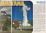
35 1/2" x 18" sheet folded to 24 panels. 2 bright, colorful cover panels, 1 panel with general information about Montana, 3 panels offer color photographs of and information about Glacier and Yellowstone National Parks. 6 panels offer color photographs of of Montana scenes throughout the various seasons. On the outskirts of the photographs are a listing of the state parks and monuments with location on map on reverse side indicated, information on fishing, hunting, and historic landmarks, information on Lewis and Clark Caverns State Park, descriptions of the various photographs, and a listing of radio stations. Opposite 12 panels offers a color map of Montana, an index to counties, cities, towns, and points of interest, and a mileage chart. Inset are small street maps of Great Falls, Helena, Billings, Butte, and Missoula. Very light rubbing to some folds. Near fine.
Inventory Number: 41305


