Dealer in Rare and First-Edition Books: Western Americana; Mystery, Detective, and Espionage Fiction

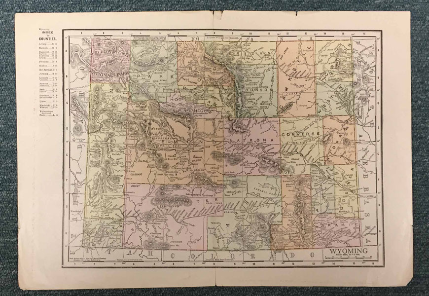
Map Of Wyoming
RAND MCNALLY & COMPANY
Other works by RAND MCNALLY & COMPANYPublication: Rand McNally & Company, Publishers, 1913, Chicago
15 1/4" x 10 3/4" color map of Wyoming with an index to the counties. Counties are colored in different pastel colors. Map shows railway lines and stops, coal fields, oil fields, cities, rivers, mountain ranges, Yellowstone National Park, etc. Appears that map was on the inside of the front and rear wrappers of a Rand-McNally Bankers' Directory as the the opposite side of the map offers "Some Facts About The Rand-McNally Bankers' Directory," and also the results of the question asked to various banks in each state in the Union, "What financial journals do you pay a subscription price for?" Of course, the majority listed The Rand-McNally Bankers' Monthly, followed closely by American Banker of the New York Weekly. Map has been professional repaired center where spine of magazine would have been. Light chipping to edges. Very nice map.
Inventory Number: 41825Sold -- Contact us


