Dealer in Rare and First-Edition Books: Western Americana; Mystery, Detective, and Espionage Fiction
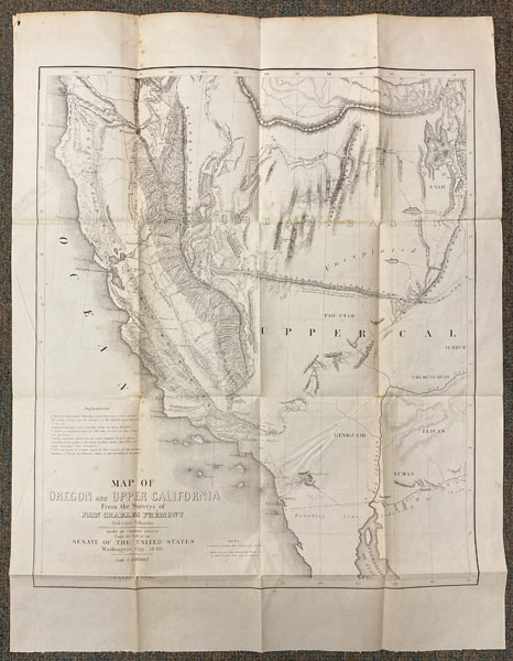
Map Of Oregon And Upper California From The Surveys Of John Charles Fremont And Other Authorities
CHARLES PREUSS
Other works by CHARLES PREUSSPublication: E Weber & Company, 1848, Baltimore
Map 49 cm x 42 cm [19.5" x 16.5"] on a single sheet [61 cm x 47 cm] / [24" x 18.5"] Folds as issued. Major and important western map. This is the first map to include reference to the Golden Gate at the entrance of San Francisco Bay and the first to locate the gold fields 'El Dorado’ or Gold Region. This map is also the first to locate the Humboldt River, that was given its name by this map. The 'Great Basin' was also named by this map. The 'Mormon Settlements' are located to the east of the Great Salt Lake. This is the rarer and smaller version, that excludes the Missouri and Oregon Territories, and only shows California and the Great Basin portion of 1848, that Fremont issued as a separate map. This is one of the only detailed reports to come out of Fremont's ill-fated Third Expedition. Folded in very good condition.
Inventory Number: 52495


![Northwest Coast Haisla [Northern Kwakiutl] Indian Hand Carved Large Yellow Cedar Totem Pole. ROBERTSON, HENRY [GA-BA-BAAWK/TEN RAVENS].](/media/images/thumb/27838.jpg)


