Dealer in Rare and First-Edition Books: Western Americana; Mystery, Detective, and Espionage Fiction
Map Of Canadian Rockies And The Triangle Tour Of British Columbia, Alaska And The Yukon
CANADIAN NATIONAL RAILWAYS
Other works by CANADIAN NATIONAL RAILWAYSPublication: Privately printed, 1927, N P
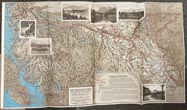
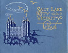
First edition. Large 30 1/2" x 17" two-sided color, pictorial map. One side provides a color map of Alaska and the Yukon and routes of the Canadian National Steamships Pacific Coast Service.. The verso is a color map of The Triangle Tour of British Columbia that includes Jasper National Park, Mount Robson Park, and Canadian Rockies, a trip of 1200 miles by rail and 550 miles by water. Housed in the printed wrappers that are illustrated on the front cover and with a map of the route of Canadian National Railways on the inside front flap. This splendid birds-eye style view of the Triangle Tour providing the viewer elevations, ship lines, trails, and park boundaries for Jasper National Park, Mount Robson Park, and the Canadian Rockets. The routes of the Canadian National Steamships are shown either in operation, or under construction, along with Canadian National Railways lines with all stations identified. Small stamp of J. W. Robinson on the front cover else a very good copy.
Inventory Number: 49349


