Dealer in Rare and First-Edition Books: Western Americana; Mystery, Detective, and Espionage Fiction
Lake Superior Copper Mines / [Title Page] A True Description Of The Lake Superior Country; Its Rivers, Coasts, Bays, Harbours, Islands And Commerce, With Bayfiled's Chart (Showing The Boundary Line Established By Joint Commission). Also A Minute Account Of The Copper Mines And Working Companies, Accompanied By A Map Of The Mineral Regions; Showing By Their No. And Place, All The Different Locations: And Containing A Concise Mode Of Assaying, Treating, Smelting, And Refining Copper Ores
JOHN R ST. JOHN
Other works by JOHN R ST. JOHNPublication: William H Graham, Tribune Buildings, 1846, New York
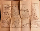
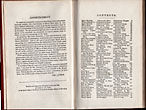
First Edition. 7 1/4" x 4 3/4" in original burnt orange cloth with gilt lettering "Lake Superior Copper Mines" on the front cover, inked script "Copper Mines" on the spine. 118 pp. Advertisement. Contents. Two folding maps. This is an early guidebook and travel narrative of the Lake Superior region written for those interested in locating and exploiting the copper, iron ore, and other geographical resources of that region. It is divided into two parts. The first is a search for evidence to substantiate the geological findings of the noted geologist Douglas Houghton. To achieve this, the author advises several means of travel (if by canoe, with an experienced "voyageur"), the proper choice of clothing, cooking utensils, and tools ("A flannel shirt will not require so often washing . . . washer-women are rather scarce . . . .”). There are descriptions of scenic beauty, of the bays, harbors, rivers, and other landmarks along the way. The second part describes the geology and potential for mineral development. There is a section detailing working companies at the time, a glossary of mining and mineral terms, a list of native minerals and ores, a vocabulary of Indian and French, a discussion of available steam and sail vessels, and the treatment of copper ores. Both maps are by Bayfield was an important British cartographer, respected for his accuracy. Map #1, entitled Bayfield's North America Sheet IV, Lake Superior measures 11 ½" x 15 3/4." Map #2, entitled The Mineral Regions of Lake Superior measures 16 3/4" x 39." Appears that possibly a blank front free fly leaf has been removed. Fading to covers and with rubbing and bumping to corners along with wear to head and toe of spine. Very good.
Inventory Number: 46025
![Lake Superior Copper Mines / [Title Page] A True Description Of The Lake Superior Country; Its Rivers, Coasts, Bays, Harbours, Islands And Commerce, With Bayfiled's Chart (Showing The Boundary Line Established By Joint Commission). Also A Minute Account Of The Copper Mines And Working Companies, Accompanied By A Map Of The Mineral Regions; Showing By Their No. And Place, All The Different Locations: And Containing A Concise Mode Of Assaying, Treating, Smelting, And Refining Copper Ores JOHN R ST. JOHN](/media/images/large/46025.jpg)


