Dealer in Rare and First-Edition Books: Western Americana; Mystery, Detective, and Espionage Fiction
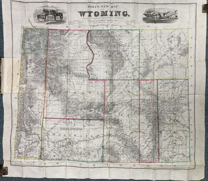
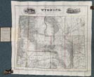
Holt's New Map Of Wyoming. Compiled By Permission From Official Records In The United States Land Office. The Only Reliable And Accurate Map Of Wyoming Ever Published, Showing All The Streams, Roads, Trails, Ranches, Grazing Grounds, Copper, Silver And Coal Mines; Soda Lakes And Oil Springs. The Mineral Locations On This Map Were Located From Official Survey By Prof. G. E. Bailey, Territorial Geologist, Cheyenne, Wyoming
GEORGE L. HOLT
Other works by GEORGE L. HOLTPublication: Published and for sale by Geo L Holt, Dealer in Books and Stationery, 1885, Cheyenne
First edition thus. 16mo. Original cloth folder, titles stamped in gilt on front cover, title of map also present in pastedown on front cover. Map measures approximately 28" x 31," with early hand-colored outlines for county borders. An extremely detailed map showing telegraph lines, overland roads, completed and projected railroad lines, local ranches, including the Wyoming Land & Cattle Company, Moreton Frewen's Powder River Cattle Company, and many other cattle companies. A beautiful copy printed on crisp, banknote style paper. Holt published the first edition of this map in 1883; this 1885 printing has a small number of changes and improvements. Wheat MAPPING THE TRANS-MISSISSIPPI WEST 1302 also notes an 1884 and 1888 printing of the map; nevertheless it is a scarce and desirable map. Streeter Sale 2254 notes an 1884 printing. Graff 1944 notes this 1885 edition. The upper margins of the map show engraved vignettes of livestock in one corner and an early manufacturing facility. The map was engraved and printed by G. W. & C. B. Colton Co., in New York City. A handsome copy housed in a clamshell case with front cover design replicated on the front cover..
Inventory Number: 49625Sold -- Contact us

