Dealer in Rare and First-Edition Books: Western Americana; Mystery, Detective, and Espionage Fiction
Guide To The Union Pacific Railroad Lands. 12,000,000 Acres. Best Farming And Mineral Lands In America, For Sale By The Union Pacific Railroad Company, In Tracts To Suit Purchasers And At Low Prices
UNION PACIFIC RAILROAD COMPANY LAND DEPARTMENT
Other works by UNION PACIFIC RAILROAD COMPANY LAND DEPARTMENTPublication: Land Department Union Pacific Railroad Company, 1870, Omaha
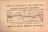
First edition. 8vo. 8 3/4" x 5 3/4" printed wrappers with map on back cover, 44 pp., introduction, illustrated, maps. The rear cover features a map of portions of Idaho, Utah, Wyoming, Colorado, Dakota, Nebraska, Kansas, Missouri, and Iowa. States where land grant bonds are available from the Union Pacific Railroad Company. The frontispiece is a map of the United States that shows the Union Pacific Railroad and its connections. A third map shows counties in Nebraska in 1870, and the Union Pacific Railroad lands, first 200 miles, grants of 1862-64. A description of the Nebraska lands are provided county by county. The available lands are contained in alternate sections of one square mile each, within a breadth of twenty miles on either side of the railroad and extend along the entire line. They extend through central Nebraska, southern Wyoming, and northern Colorado and Utah, and include within their limits the splendid agricultural lands of the Platte Valley, the great natural pastures of the Laramie Plains and the valleys of Lodge Pole Creek and Bear River, and the rich iron and coal fields between the Black Hills and the Wahsatch Mountains. Description, advantages, water resources, climate, soil, live stock raising, farming, markets, timber, minerals, information about homesteads, advantages of living in colonies, etc. Both Adams' Herd and Graff list similar titles but different years and claim their listings to be "rare." A small bump to the top edges, light wear to the spine ends, else a near fine copy.
Inventory Number: 44035


