Dealer in Rare and First-Edition Books: Western Americana; Mystery, Detective, and Espionage Fiction
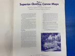
Fisher's Superior-Quetico Canoe Maps Covering The Superior National Forest In Minnesota & Quetico Provincial Park In Ontario
W. A. FISHER COMPANY
Other works by W. A. FISHER COMPANYPublication: Published and Lithographed by W A Fisher Company, 1952, Virginia, Minnesota
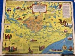
First edition Large folio [approximately 22" x 17"] original color pictorial stiff wrappers, n. p. (32 pp.), illustrated by 15 color maps with chart index on verso of each map. The purpose of the Superior-Quetico maps is to provide accurate maps that may be used to plan a route and also to serve as a guide on a trip especially when passing from one lake to another. All maps of the area have been drawn from aerial surveys prepared by the United States and Canadian governments. The large front cover has been neatly reattached by a master paper conservator, some minor nicks and closed tears to the fore edges, and a vertical crease in the center, else a very good copy. This is a large and item and some extra postage will apply.
Inventory Number: 48848Sold -- Contact us


