Dealer in Rare and First-Edition Books: Western Americana; Mystery, Detective, and Espionage Fiction
Exploration And Survey Of The Valley Of The Great Salt Lake Of Utah, Including A Reconnaissance Of A New Route Through The Rocky Mountains
CAPT HOWARD STANSBURY
Other works by CAPT HOWARD STANSBURYPublication: Robert Armstrong Public Printer, 1853, Washington
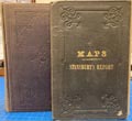
Senate edition, Executive Document No. 3, Special Session, March, 1851. 2 volumes. Cloth, 495 pp. + 2 large folding maps in separate portfolio volume. 58 plates, including folding panoramic views. Many appendices, charts, tables, index. This is the first extensive survey of the Great Basin, and a major landmark in the cartography of the American West. "Captain Stansbury, commanded the detachment of the Army's topographical engineers which was directed in 1849 to explore and report on the Great Salt Lake Basin. Of particular interest were the newly established Mormon settlements, and the routes and passes through the Rockies for emigrants and possibly a railroad."---Wagner-Camp 219:1. In Mapping The Transmississippi West, Vol.3, pp.117-127, Carl Wheat describes the explorations of Stansbury and Lt. John Gunnison, and the important maps issued with this work as created by Stansbury; Gunnison; famous cartographer, Charles Preuss; and Albert Carrington. Both of the large maps are housed in a matching slipcase. Both maps are in very good condition. According to Wheat: "A good many details were added for the country lying between the established Oregon-California trail and Fremont's return from California in 1844, and these, together with the new cartography of the Great Salt Lake region, make the Stansbury expedition map one of the most important of its decade." Original cloth with gilt stamped back strip. Gentle wear to hinges otherwise very good copies. Complete with all 58 plates and the two large folding maps.
Inventory Number: 50033


![Northern Arizona Death And Burial Records 1936-1969 WHITESIDE, DORA M. [COMPILED BY]](/media/images/thumb/46505.jpg)


