Dealer in Rare and First-Edition Books: Western Americana; Mystery, Detective, and Espionage Fiction

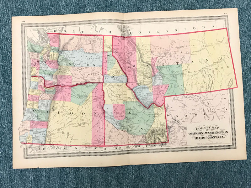
County Map Of Oregon, Washington, Idaho And Montana
H.H LLOYD
Other works by H.H LLOYDPublication: DL Guernsey, 1872, Concord & Boston
From Lloyd's Handy Atlas ...(pp. 82-83). 14 5/8" x 22 1/4," double-page, hand-colored map of the Territories of Washington, Idaho and Montana and the State of Oregon. In addition to indicting rivers, mountains, cities, etc., map indicates various camps, locations of various Indian tribes, overland routes, etc. Extremities toned and with a tiny chip to lower margin. Near fine. Surprisingly scarce.
Inventory Number: 42626Sold -- Contact us


![Patent For An Improvement In Type Bars And Supports For A Type-Writer, Submitted By John Winsor Of Pennsylvania In 1898 SIGGERS, E.G. [PATENT SOLICITOR & LAWYER]](/media/images/thumb/49265.jpg)


