Dealer in Rare and First-Edition Books: Western Americana; Mystery, Detective, and Espionage Fiction
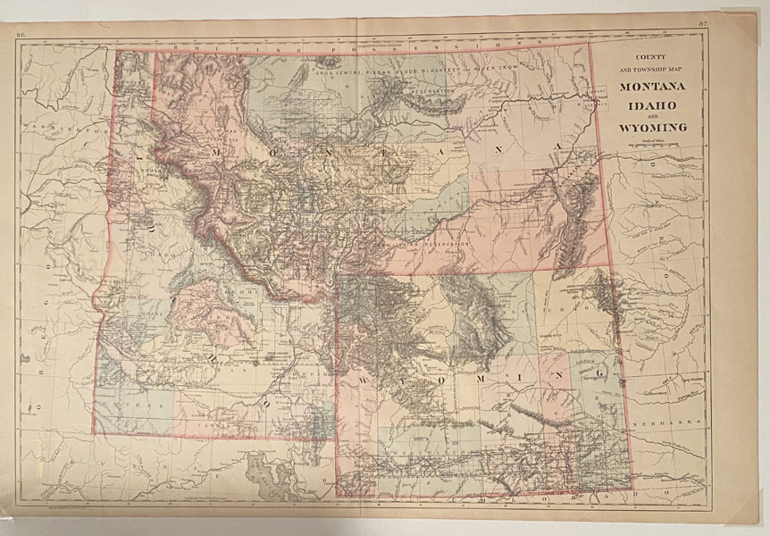
County And Township Map: Montana, Idaho, And Wyoming
Publication: Wm M Bradley, 1887, NP
An attractive, very detailed, hand-colored map. 21.25" x 14.5." Scale 42 miles = 1." Also shows bordering portions of British Possessions, Washington, Oregon, Nevada, Utah, Colorado, Nebraska, and Dakota Territory. Hand-colored to show boundaries for counties and townships in Montana, Idaho, and Wyoming. All natural features are identified: lakes, rivers, creeks, rapids, springs, wells, mountains, hills, buttes, mountain passes, etc. Cities, towns, mines, missions, agencies, battlegrounds, and numerous military forts are shown. Several railroads are identified including: the Northern Pacific Railroad, Union Pacific Railroad, Central Pacific Railroad, Oregon Short Line Railroad, and Utah & Northern Division of the Union Pacific Railroad. State roads and travel routes are shown. Numerous Indian reservations are shown: Wind River Shoshone Indian Reservation; Kootnai Indian Reservation; Flathead Indian Reservation; Crow Indian Reservation; Nez Perces Indian Reservation; Gros Ventres, Piegan, Blood, Blackfeet, and River Crow Indian Reservations; and Arickarees, Gros Ventre, and Mandan Indian reservation. A fine, bright copy.
Inventory Number: 34019


