Dealer in Rare and First-Edition Books: Western Americana; Mystery, Detective, and Espionage Fiction
Compendium Of Information Concerning The City Of Tacoma And Washington Territory
ALLEN C. MASON
Other works by ALLEN C. MASONPublication: A Anderson & Co, Printers, 1888, Portland
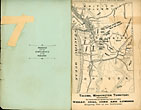
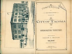
Second edition. 8vo. Original printed light green wrappers, 110 pp., frontispiece of map and home of Allen C. Mason. Scarce second edition, following the first of the previous year. This edition is more than double the length of the first edition, and adds a map of Washington and northern Oregon. Mason was a prominent real estate loan broker in Tacoma, and a booster of the region and the territory. The map shows the railroad lines in the area, and the frontispiece shows Mason’s office building. The text gives an overview of Washington Territory followed by an overview of Western Washington, Puget Sound, and Eastern Washington, describing climate, timber, coal, fishing, commerce, railways, agricultural development, hops, raising stock, production of lumber, etc. These overviews are followed by information on education, facts & figures on commerce, Colville, the Okanagan Mines, salmon fisheries, ship-building business, horticulture, various land laws, and with detailed information on various counties to include Pierce, Lewis, Chehalis, Thurston, Snohomish, Skagit, Whatcm, Yakima, Kittitas, Cowlitz, Franklin, and Lincoln Counties. Booklet continues on with 36 pages of detailed information on Tacoma and all that it has to offer. Not in Howes, and scarce on the market. Covers moderately soiled with fore-edges with nicks and closed tears that have been repaired with tape on the verso. Map/frontispiece leaf is worn at the fore-edge, small closed tear to the outer margin of the first twenty leaves not affecting the text, else a good, tight copy.
Inventory Number: 45485


