Dealer in Rare and First-Edition Books: Western Americana; Mystery, Detective, and Espionage Fiction
Come To Prince Edward Island, Canada
Publication: Privately printed, nd ca 1960, NP
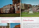
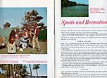
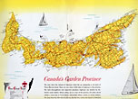
9 3/4" x 6 5/8" in stiff color pictorial wrappers with beach scene to front wrapper. 40 pp., color illustrations, map. General overview of the area followed by information about parks and campgrounds, sports and recreation, historic sites, churches and colleges, urban centers, shopping and dining, along with information about how to get to the island. Booklet has color photographs on every page with boating and beach scenes, individuals participating in various activities, camping scenes, sporting events, etc. At center is a double-page map of Prince Edward Island showing the network of highways linking all parts of the island. Lightly soiled and with light wear to the extremities along with light water stain to inside bottom corner. Still very good.
Inventory Number: 38616


![Pictorial History And Guide Book Of Saint Augustine. The Oldest City In The United States ST. AUGUSTINE INSTITUTE OF SCIENCE & HISTORICAL SOCIETY]](/media/images/thumb/40351.jpg)


