Dealer in Rare and First-Edition Books: Western Americana; Mystery, Detective, and Espionage Fiction
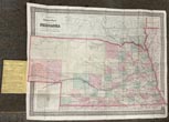
Colton's Township Map Of The State Of Nebraska Drawn, Engraved And Published By G. W. & C. B. Colton & Co.,
G. W. & C. B. COLTON & CO.
Other works by G. W. & C. B. COLTON & CO.Publication: Published by G W & C B Colton & CO, 1875, New York
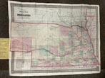
Folding map 45.3 x 59 cm [17 7/8" x 23 1/4"] affixed to rear inside original blind-stamped, cloth binder with titles stamped in gilt on the front cover. An attractive map with a decorative border showing the state of Nebraska divided into counties and then further into townships. State borders are highlighted in bright magenta, and counties are colored in shades of yellow, orange, green, and pink. Rivers and streams are shown as well as the line of the Union Pacific Railway Company and the various stops along the route. Proposed railroads and those in progress are also noted. Some small separations neatly repaired, minor scattered discoloration and spotting, else a very good copy.
Inventory Number: 50298


