Dealer in Rare and First-Edition Books: Western Americana; Mystery, Detective, and Espionage Fiction
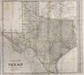
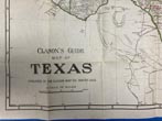
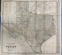
Clason's Guide To Texas, With Map Of Auto Routes. (Cover Title)
THE CLASON MAP COMPANY
Other works by THE CLASON MAP COMPANYPublication: Published By The Clason Map Co,1911, Denver
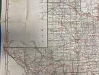
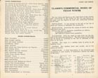
First edition. 16mo. 6 1/4" x 4" dark green pictorial, stiff wrappers, 80 pp., advertisements, tables, folding map. Large 21" x 23" folding color map, with local and transcontinental highways marked in red, or bold red. First edition of one of the earliest, if not the first, scarce automobile travel maps of Texas in the Brass Era, with the state highways and “Transcontinental Auto Roads” marked on the map, showing the nascent efforts of the "Good Roads" movement to encourage motoring in the West. Before World War I, travel on Texas roads and highways was often an adventure in frustration, featuring bumpy dusty rutted unpaved roads, slogging through mud mires, dead-ending on highways which maps, or locals, insisted cold continue. Featured on this map are the Colorado to Gulf Highway (later Highway 9); the Southern National Highway (later Highways 90, 290 & 3); the Meridian Road which would later become Highway 77 through Oklahoma City, and many others. This Clason Commercial Index to Texas Towns, offers populations, elevations, banks & hotels. Worldcat locates 1 copy (Baylor). Not in Rumsey's collection. Minor bump to upper right front corner, small closed tear at upper left of map carefully repaired on verso, and a few small fold crease tears. Overall a very good copy.
Inventory Number: 49370




![Wanderings In The Southwest In 1855 By J. D. B. Stillman. STILLMAN, J. D. B [EDITED WITH AN INTRODUCTION BY RON TYLER]](/static/basic_cms_store2/img/CoverNotFound2.jpg)
![Eyewitness To The Fetterman Fight, Indian Views MONNETT, JOHN H. [EDITED BY]](/media/images/thumb/51679.jpg)


