Dealer in Rare and First-Edition Books: Western Americana; Mystery, Detective, and Espionage Fiction

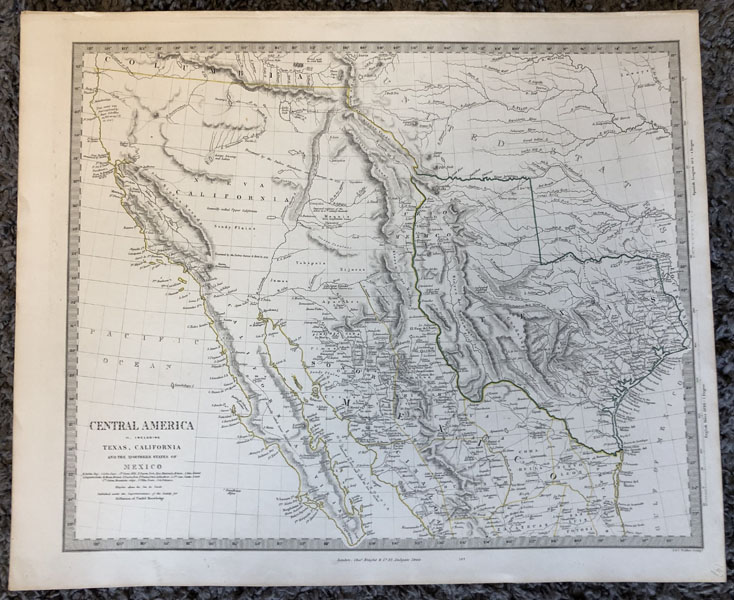
Central America, Sheet Ii., Including Texas, California, And The Northern States Of Mexico
CHARLES KNIGHT
Other works by CHARLES KNIGHTPublication: The Superintendence of the Society for the Diffusion of Useful Knowledge, 1844, London
A Fine, Hand-colored Map. Sheet 17"x14". Printed area 15.25"x12.5". Engraved by J. & C. Walker. Published by Charles Knight, London 1844. One of the most collectible 19th century maps of North America, this map features the independent Republic of Texas. The hand-colored borders of Texas include the Gulf of Mexico, the Red and the Sabine rivers. It extends north to the Arkansas river north of today's Panhandle. North of the Red and Arkansas rivers is the United States. The southern and western borders are the Rio Grande de Norte and extends into today's Colorado, claiming much of Nueva Mexico. West of Texas is Mexico and Nueva California. North of Nueva California is Columbia. The borders are all hand-colored, as are the borders of the various States in Mexico. Very detailed and finely printed, showing cities, lakes, rivers, mountains, and all natural features. The title of the map is misleading in that it covers only northern Mexico. In latitude it ranges from 23 degrees North to 42 degrees North. Longitude extends from 92 degrees to 125 degrees. A near Fine copy of this important, attractive, and framable map.
Inventory Number: 50340


