Dealer in Rare and First-Edition Books: Western Americana; Mystery, Detective, and Espionage Fiction
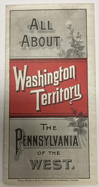
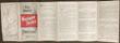
All About Washington Territory. The Pennsylvania Of The West
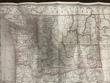
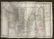
Northern Pacific Railroad
Other works by Northern Pacific RailroadPublication: Rand, McNally & Co, 1888, Chicago
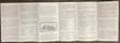
20 3/4" x 13 1/2" sheet, folded to 24 panels. Map. One cover panel; one panel showing N.P.R.R. route from Minneapolis to Washington Territory; and 10 panels of information to include information on the area's location and physical features, climate, agriculture, stock raising, manufacturing, mining, public schools, cities and towns, etc. Opposite 12 panels offer a map of Washington Territory, printed in red and black. A rare promotional piece to encourage sales of Northern Pacific Railroad lands in Washington Territory. Light soling, a few small splits to creases and with minor wear to the extremities. Very good.
Inventory Number: 53587$950.00