
Dealer in Rare and First-Edition Books: Western Americana; Mystery, Detective, and Espionage Fiction
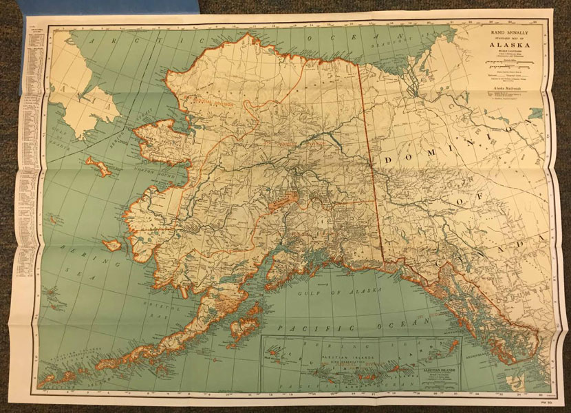

Alaska Pocket Map Showing Cities - Towns - Rivers - Lakes - Political Divisions
Rand Mcnally And Company
Other works by Rand Mcnally And CompanyPublication: Privately printed, nd ca 1940, NP
19 3/4" x 27" map, folded to 30 panels and housed in 9 1/4 x 4 1/4" blue printed covers. 15-panel map showing Alaska and the western portion of the Dominion of Canada. Printed in green and cream, with judicial division boundaries in orange. 1" = 64 statute miles. In addition to cities, towns, lakes, rivers, etc., map shows railroad and telegraph lines. Running down side edge is a listing of principal cities along with their populations and positions on the map. Opposite side offers an index of cities, districts, capes and points, islands, lakes, mountains, rivers and creeks, etc. Map fine. Over-sized housing covers are lightly soiled and with wear to the extremities.
Inventory Number: 41614Sold -- Contact us