Dealer in Rare and First-Edition Books: Western Americana; Mystery, Detective, and Espionage Fiction
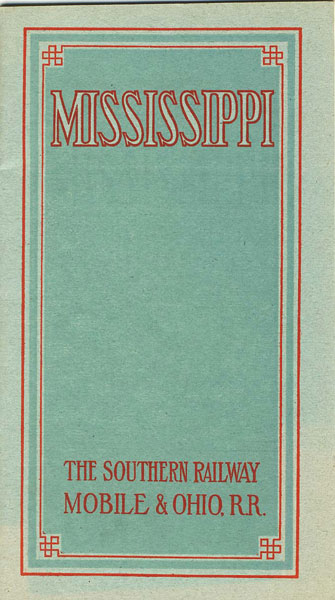
Mississippi
Southern Railway (&) Mobile & Ohio Railroad
Other works by Southern Railway (&) Mobile & Ohio RailroadPublication: The Carnaham Press, ca 1914, Washington
8" x 4.5" printed wrappers. 36 pages, illustrations. Information on all regions, climate and health, soil, agriculture, live stock, grains, fruit, pecans, forest wealth, manufacturers, transportation, schools, cities and towns, and land available - the best being in the Black Soil Belt and Yazoo Delta region, for as much as $60 - $80 per acre. Double-page map of the Southeast depicting the Southern Railway, Mobile & Ohio Railroad, Georgia Southern & Florida Railway, Virginia & Southwestern Railway and connections. a one-page map of the Mobile & Ohio Railroad in Mississippi. Very good copy of an informative booklet.
Inventory Number: 34352Sold -- Contact us